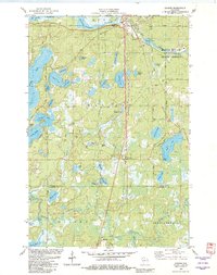
1982 Map of Gordon
USGS Topo · Published 1982About this map
The St Croix Flowage and the convergence of the Eau Claire River and St Croix River define the landscape of northern Wisconsin in the early 1980s. The settlement of Gordon serves as a local hub near the Wayside Park, while further south, the community of Wascott sits along the Chicago and North Western rail line. This period shows a transition toward recreation and conservation, with much of the eastern terrain protected within the Brule River State Forest.
Find a feature on this map
48 named features on this map. Tap any name to fly to it.
Don’t see what you’re looking for? This feature index may not catch every label — zoom into the map to look around manually.
Map Details
Editions of this 1982 Gordon Map
This is the sole edition of this map. No revisions or reprints were ever made.
Other maps of this area

1945 · Highland
USGS Topo · 1:48,000

1945 · Solon Springs
USGS Topo · 1:48,000

1947 · Chittamo
USGS Topo · 1:48,000

1947 · Minong
USGS Topo · 1:48,000

1949 · Solon Springs
USGS Topo · 1:48,000

1949 · Chittamo
USGS Topo · 1:48,000

1949 · Minong
USGS Topo · 1:48,000

1949 · Highland
USGS Topo · 1:48,000

1953 · Ashland
USGS Topo · 1:250,000

1958 · Ashland
USGS Topo · 1:250,000