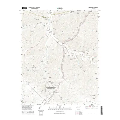
2016 Map of Gordonsburg
USGS Topo · Published 2016About this map
The Natchez Trace Parkway and National Scenic Trail bisects this landscape, following the ridgeline through the heart of the Tennessee hills. This corridor, an ancient path of commerce and travel, defines the regional geography as it crosses from the Hickman Co line into Lewis County. The settlement of Gordonsburg serves as a local focal point near Kittrell Hill, while the small community of Salem is situated to the north along Salem Rd. The terrain is characterized by a dense network of named hollows, such as Sugarcamp Hollow and Faucette Hollow, which drain into several branches of Swan Creek. For those researching local families, numerous small burial grounds are documented, including Mount Sinai Cem, Gordonsburg Cem, and the uniquely named Bradford Hollow English Camp Hollow, providing a clear record of the area's rural heritage and burial traditions.
Find a feature on this map
133 named features on this map. Tap any name to fly to it.
Don’t see what you’re looking for? This feature index may not catch every label — zoom into the map to look around manually.
Map Details
Editions of this 2016 Gordonsburg Map
This is the sole edition of this map. No revisions or reprints were ever made.
Other maps of this area

1901 · Colombia
USGS Topo · 1:125,000

1905 · Waynesboro
USGS Topo · 1:125,000

1936 · Riverside
USGS Topo · 1:24,000

1936 · Mt Joy
USGS Topo · 1:24,000

1936 · Beaverdam Springs
USGS Topo · 1:24,000

1936 · Henryville
USGS Topo · 1:24,000

1936 · Sunrise
USGS Topo · 1:24,000

1936 · Crestview
USGS Topo · 1:24,000

1936 · Greenfield Bend
USGS Topo · 1:24,000

1936 · Kimmins
USGS Topo · 1:24,000