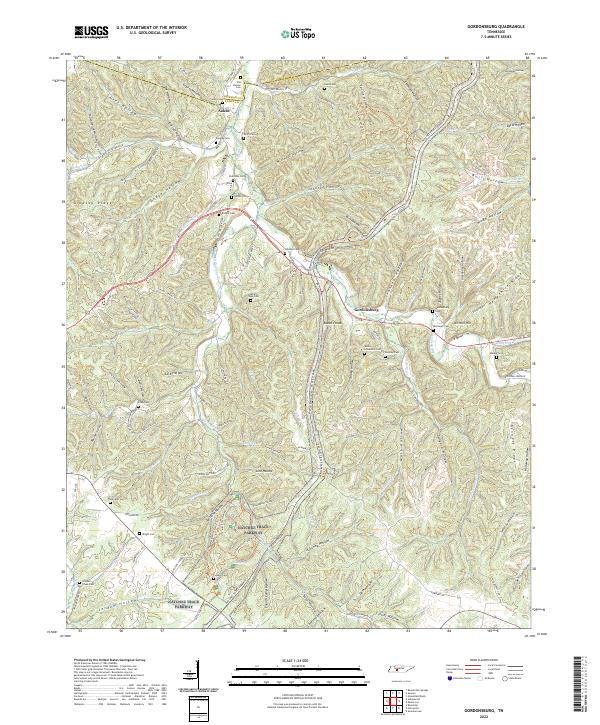
2022 Map of Gordonsburg
USGS Topo · Published 2022About this map
The Gordonsburg area of Tennessee is defined by the high, wooded ridges and deep hollows of the Western Highland Rim. This modern survey illustrates the enduring legacy of early settlement patterns, where numerous family cemeteries like Palestine Cem, Harder Cem, and Rhodes Cem are tucked away near the headwaters of creeks such as Big Swan Cr and Grinders Cr. The Natchez Trace Parkway bisects the landscape, following the ancient migratory and trade route that once connected the Cumberland River to the Mississippi.
Find a feature on this map
126 named features on this map. Tap any name to fly to it.
Don’t see what you’re looking for? This feature index may not catch every label — zoom into the map to look around manually.
Map Details
Editions of this 2022 Gordonsburg Map
This is the sole edition of this map. No revisions or reprints were ever made.
Other maps of this area

1901 · Colombia
USGS Topo · 1:125,000

1905 · Waynesboro
USGS Topo · 1:125,000

1936 · Riverside
USGS Topo · 1:24,000

1936 · Mt Joy
USGS Topo · 1:24,000

1936 · Beaverdam Springs
USGS Topo · 1:24,000

1936 · Henryville
USGS Topo · 1:24,000

1936 · Sunrise
USGS Topo · 1:24,000

1936 · Crestview
USGS Topo · 1:24,000

1936 · Greenfield Bend
USGS Topo · 1:24,000

1936 · Kimmins
USGS Topo · 1:24,000