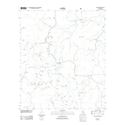
2012 Map of Gorum
USGS Topo · Published 2012About this map
Gorum serves as a central hub for this rural stretch of Natchitoches Parish, situated where Mora Gorum Rd and Lake Gorum Rd meet. The landscape is defined by the extensive drainage systems of Bayou Pierre and Bayou Cypre, which carve through the timberlands and ridges. Local topography is marked by distinctive elevations such as Chopin Camp Ridge and Sunk Hill, while the Gorum Lookout Tower stands as a prominent man-made landmark overseeing the forest. Family names are deeply etched into the geography, visible in road names like Ezzie Basco Rd and Paul Basco Rd. The presence of several burial grounds, including Emanuel Cem, Bottom Cem, and Gorum Cem, provides significant points of interest for genealogists tracing the residents of outlying settlements like Janie and Sampusand. This map documents the persistent rural character of the region as it transitioned into the early 21st century.
Find a feature on this map
62 named features on this map. Tap any name to fly to it.
Don’t see what you’re looking for? This feature index may not catch every label — zoom into the map to look around manually.
Map Details
Editions of this 2012 Gorum Map
This is the sole edition of this map. No revisions or reprints were ever made.
Other maps of this area

1937 · Chopin NE
USGS Topo · 1:31,680

1937 · Chopin SW
USGS Topo · 1:31,680

1937 · Chopin NW
USGS Topo · 1:31,680

1937 · Aloha
USGS Topo · 1:31,680

1937 · Montgomery
USGS Topo · 1:62,500

1937 · Chopin SE
USGS Topo · 1:31,680

1937 · Cloutierville
USGS Topo · 1:31,680

1937 · Cypress
USGS Topo · 1:31,680

1942 · Kisatchie
USGS Topo · 1:62,500

1942 · Montgomery
USGS Topo · 1:62,500