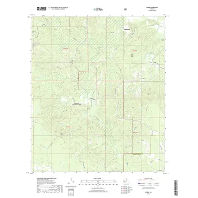
2018 Map of Gorum
USGS Topo · Published 2018About this map
Gorum and the surrounding piney woods of Kisatchie National Forest characterize this part of Natchitoches Parish. The landscape is defined by a dense network of watercourses, including Bayou Pierre, Bayou Barbue, and Little Bayou Pierre, which carve through the undulating terrain of Chopin Camp Ridge and Sunk Hill. This survey captures the rural character of the region, where small settlements like Sampusand and Janie are connected by a web of local routes such as Emmanuel Rd and the Janie-Gorum Rd. Genealogists will find several burial sites preserved here, including Gorum Cem, Emanuel Cem, and Botton Cem. The presence of the Longleaf Vista Trail and Turpentine Hill Trail highlights the area's legacy of timber and forest management, while distinctive landforms like Negro Foot Hill and Mossy Point provide unique local reference points.
Find a feature on this map
65 named features on this map. Tap any name to fly to it.
Don’t see what you’re looking for? This feature index may not catch every label — zoom into the map to look around manually.
Map Details
Editions of this 2018 Gorum Map
This is the sole edition of this map. No revisions or reprints were ever made.
Other maps of this area

1937 · Chopin NE
USGS Topo · 1:31,680

1937 · Chopin SW
USGS Topo · 1:31,680

1937 · Chopin NW
USGS Topo · 1:31,680

1937 · Aloha
USGS Topo · 1:31,680

1937 · Montgomery
USGS Topo · 1:62,500

1937 · Chopin SE
USGS Topo · 1:31,680

1937 · Cloutierville
USGS Topo · 1:31,680

1937 · Cypress
USGS Topo · 1:31,680

1942 · Kisatchie
USGS Topo · 1:62,500

1942 · Montgomery
USGS Topo · 1:62,500