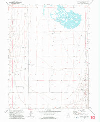
1993 Map of Goshen Pass
USGS Topo · Published 1993About this map
Cedar Valley defines the expansive basin of this 1993 survey, showing a landscape shaped by water scarcity and distinct drainage patterns in Utah County. The northern section is dominated by the Sinks, a complex topographical depression where surface water collects and disappears into the ground. Traces of human activity are centered on livestock and water management, evidenced by the presence of a Corral and several remote water sources like Yellowbrush Well and a distributed Water Tank. To the southeast, the terrain rises toward the namesake Goshen Pass, providing a corridor through the mountainous topography that borders the valley floor. This map captures the region at a time when its character remained primarily focused on rural ranching and geological features before more modern developments moved into the area.
Find a feature on this map
8 named features on this map. Tap any name to fly to it.
Don’t see what you’re looking for? This feature index may not catch every label — zoom into the map to look around manually.
Map Details
Editions of this 1993 Goshen Pass Map
This is the sole edition of this map. No revisions or reprints were ever made.
Other maps of this area

1885 · Salt Lake
USGS Topo · 1:250,000

1885 · Tooele Valley
USGS Topo · 1:250,000

1915 · Fairfield
USGS Topo · 1:62,500

1917 · Fairfield
USGS Topo · 1:62,500

1947 · Fivemile Pass
USGS Topo · 1:62,500

1947 · Allens Ranch
USGS Topo · 1:24,000

1947 · Boulter Peak
USGS Topo · 1:24,000

1947 · Goshen Pass
USGS Topo · 1:24,000

1949 · Allens Ranch
USGS Topo · 1:24,000

1949 · Fivemile Pass
USGS Topo · 1:24,000