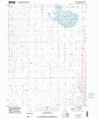
1997 Map of Goshen Pass
USGS Topo · Published 2001About this map
The expanse of Cedar Valley dominates this 1997 topographic survey, illustrating a high-desert landscape defined more by natural hydrology and elevation than by dense settlement. In the northern reaches, the seasonal drainage patterns of the Sinks create a complex network of dry washes beneath the eastern slopes of Eagle Mountain. This area, bordered by a Corporate Boundary, reflects the early phases of urban expansion into once-isolated territory.
Find a feature on this map
9 named features on this map. Tap any name to fly to it.
Don’t see what you’re looking for? This feature index may not catch every label — zoom into the map to look around manually.
Map Details
Editions of this 1997 Goshen Pass Map
This is the sole edition of this map. No revisions or reprints were ever made.
Other maps of this area

1885 · Salt Lake
USGS Topo · 1:250,000

1885 · Tooele Valley
USGS Topo · 1:250,000

1915 · Fairfield
USGS Topo · 1:62,500

1917 · Fairfield
USGS Topo · 1:62,500

1947 · Fivemile Pass
USGS Topo · 1:62,500

1947 · Allens Ranch
USGS Topo · 1:24,000

1947 · Boulter Peak
USGS Topo · 1:24,000

1947 · Goshen Pass
USGS Topo · 1:24,000

1949 · Allens Ranch
USGS Topo · 1:24,000

1949 · Fivemile Pass
USGS Topo · 1:24,000