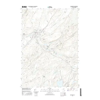
2016 Map of Gouverneur
USGS Topo · Published 2016About this map
The Oswegatchie River defines the industrial and residential heart of this Saint Lawrence County region, winding through the village of Gouverneur and smaller settlements like Hailesboro and Natural Dam. This 2016 survey provides a clear look at the contemporary layout of these historic river towns, where the water's path influenced early development and industry. In the surrounding countryside, family and community history is preserved in locations such as Riverside Cem and Saint James Cem, while the southern reaches show the rural character around West Fowler and the waters of Sylvia Lake.
Find a feature on this map
95 named features on this map. Tap any name to fly to it.
Don’t see what you’re looking for? This feature index may not catch every label — zoom into the map to look around manually.
Map Details
Editions of this 2016 Gouverneur Map
This is the sole edition of this map. No revisions or reprints were ever made.
Other maps of this area

1911 · Antwerp
USGS Topo · 1:62,500

1912 · Hammond
USGS Topo · 1:62,500

1913 · Lake Bonaparte
USGS Topo · 1:62,500

1915 · Gouverneur
USGS Topo · 1:62,500

1916 · Lake Bonaparte
USGS Topo · 1:62,500

1937 · Gouverneur
USGS Topo · 1:62,500

1944 · Hammond
USGS Topo · 1:62,500

1948 · Ogdensburg
USGS Topo · 1:250,000

1949 · Hammond
USGS Topo · 1:62,500

1949 · Antwerp
USGS Topo · 1:62,500