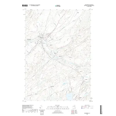
2019 Map of Gouverneur
USGS Topo · Published 2019About this map
The Oswegatchie River carves a winding path through this corner of Saint Lawrence County, anchoring settlements like Gouverneur and Hailesboro. The landscape is a complex mix of elevated points such as Battle Hill and Reservoir Hill and low-lying wetlands including Abbots Swamp and Myers Swamp. Genealogy researchers can find several burial grounds documented here, from the modern Riverside Cem to the Old Saint James Cem, offering a spatial record of the area's development. Near the village of Fowler, the terrain softens toward Sylvia Lake, where a network of shoreline roads like E Shore Rd and W Shore Rd indicates established lakeside activity. The presence of Hailes Hopyard and named fields like Hendricks Field reflects the agricultural character that remains a defining element of this rural New York region.
Find a feature on this map
94 named features on this map. Tap any name to fly to it.
Don’t see what you’re looking for? This feature index may not catch every label — zoom into the map to look around manually.
Map Details
Editions of this 2019 Gouverneur Map
This is the sole edition of this map. No revisions or reprints were ever made.
Other maps of this area

1911 · Antwerp
USGS Topo · 1:62,500

1912 · Hammond
USGS Topo · 1:62,500

1913 · Lake Bonaparte
USGS Topo · 1:62,500

1915 · Gouverneur
USGS Topo · 1:62,500

1916 · Lake Bonaparte
USGS Topo · 1:62,500

1937 · Gouverneur
USGS Topo · 1:62,500

1944 · Hammond
USGS Topo · 1:62,500

1948 · Ogdensburg
USGS Topo · 1:250,000

1949 · Hammond
USGS Topo · 1:62,500

1949 · Antwerp
USGS Topo · 1:62,500