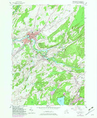
1982 Map of Gouverneur
USGS Topo · Published 1983About this map
The Oswegatchie River dominates the northern landscape of this St. Lawrence County region, winding past the village of Gouverneur and through industrial hubs like Natural Dam and Hailesboro. This 1982 photorevised survey reveals a multifaceted community where institutional landmarks like Noble Hospital and the High Sch anchor the town center, while the southern quadrant shows the active industrial presence of mining operations at No 2 Shaft and No 3 Shaft near Balmat. Cultural and transit history is preserved through the mapping of the Drive-in Theater, the Ryders Skyport, and the expansive Riverside Cem. The transition from the settled river valley to the more rugged terrain of Battle Hill and the wetlands of Abbots Swamp illustrates the varied land use of the late twentieth century, captured here just before significant rural infrastructure changes.
Find a feature on this map
51 named features on this map. Tap any name to fly to it.
Don’t see what you’re looking for? This feature index may not catch every label — zoom into the map to look around manually.
Map Details
Editions of this 1982 Gouverneur Map
This is the sole edition of this map. No revisions or reprints were ever made.
Other maps of this area

1911 · Antwerp
USGS Topo · 1:62,500

1912 · Hammond
USGS Topo · 1:62,500

1913 · Lake Bonaparte
USGS Topo · 1:62,500

1915 · Gouverneur
USGS Topo · 1:62,500

1916 · Lake Bonaparte
USGS Topo · 1:62,500

1937 · Gouverneur
USGS Topo · 1:62,500

1944 · Hammond
USGS Topo · 1:62,500

1948 · Ogdensburg
USGS Topo · 1:250,000

1949 · Hammond
USGS Topo · 1:62,500

1949 · Antwerp
USGS Topo · 1:62,500