2023 Map of Gowanda
USGS Topo · Published 2023About this map
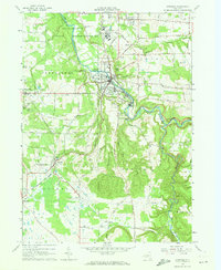
Cattaraugus Creek carves a deep path through this landscape, marking the boundary between Erie and Cattaraugus counties. The settlement of Gowanda serves as the focal point, situated at a bend in the creek where local industry and history converge. To the north, the Gowanda Psychiatric Center Memorial Cem and Buffalo Street Presbyterian Cem offer significant points of interest for genealogists tracing families in the southern Tier. The terrain is defined by dramatic depressions like Zoar Valley and Skinner Hollow, which contrast with the agricultural plains surrounding Collins and Dayton. The map documents a dense network of country roads such as Vail Rd and Taylor Hollow Rd that connect smaller hamlets like Bagdad, Markhams, and Persia. Numerous historical burial sites, including the Pioneer Methodist Cem and Saint Pauls of the Cross Cem, are preserved here, anchoring the rural landscape to its 19th-century roots.
Find a feature on this map
101 named features on this map. Tap any name to fly to it.
Don’t see what you’re looking for? This feature index may not catch every label — zoom into the map to look around manually.
Map Details
Editions of this 2023 Gowanda Map
This is the sole edition of this map. No revisions or reprints were ever made.