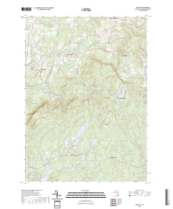
2023 Map of Grafton
USGS Topo · Published 2023About this map
Highlands and glacial ponds define the terrain of Rensselaer County, where the sprawling Grafton Lakes State Park protects a significant cluster of water bodies including Long Pond, Mill Pond, and White Lily Pond. The settlement of Grafton sits at the heart of this landscape, flanked by the drainage of the Quacken Kill and Sunkaissia Creek. The map reveals a transition from these protected wooded uplands to the agricultural and residential pockets of East Grafton, Boyntonville, and Potter Hill to the north and east.
Find a feature on this map
108 named features on this map. Tap any name to fly to it.
Don’t see what you’re looking for? This feature index may not catch every label — zoom into the map to look around manually.
Map Details
Editions of this 2023 Grafton Map
This is the sole edition of this map. No revisions or reprints were ever made.
Other maps of this area

1888 · Berlin
USGS Topo · 1:62,500

1890 · Berlin
USGS Topo · 1:62,500

1893 · Cohoes
USGS Topo · 1:62,500

1893 · Troy
USGS Topo · 1:62,500

1894 · Berlin
USGS Topo · 1:62,500

1895 · Troy
USGS Topo · 1:62,500

1895 · Cohoes
USGS Topo · 1:62,500

1897 · Hoosick
USGS Topo · 1:62,500

1898 · Berlin
USGS Topo · 1:62,500

1898 · Cohoes
USGS Topo · 1:62,500