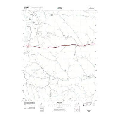
2010 Map of Grahn
USGS Topo · Published 2010About this map
Tygarts Creek snakes through the northwestern corner of this landscape, carving out the narrow Tygart Canyon and dramatic landforms like the Devils Backbone and Box Canyon. Near the bend of the creek, the Old Hanging Prison Wall Gardens and Fern Bridge mark a pocket of localized history and engineering. This region is characterized by a dense network of hollows and ridges, with small settlements like Grahn and Aden connected by winding roads such as Oats Hill Rd and Sinking Creek Rd. The presence of the Aden Tunnel reflects the historical importance of rail or transit routes through this dissected plateau. Genealogists can find several family burial grounds, including the Bailey Cemetery, Everman Cemetery, and Colley Cemetery, which are scattered among the ridges of Biggs Hill and Mayo Hill.
Find a feature on this map
87 named features on this map. Tap any name to fly to it.
Don’t see what you’re looking for? This feature index may not catch every label — zoom into the map to look around manually.
Map Details
Editions of this 2010 Grahn Map
This is the sole edition of this map. No revisions or reprints were ever made.
Other maps of this area

1903 · Kenova
USGS Topo · 1:125,000

1904 · Kenova
USGS Topo · 1:125,000

1950 · Bruin
USGS Topo · 1:24,000

1950 · Grahn
USGS Topo · 1:24,000

1950 · Wesleyville
USGS Topo · 1:24,000

1950 · Olive Hill
USGS Topo · 1:24,000

1950 · Ault
USGS Topo · 1:24,000

1950 · Tygarts Valley
USGS Topo · 1:24,000

1953 · Grayson
USGS Topo · 1:24,000

1953 · Oldtown
USGS Topo · 1:24,000