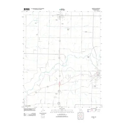
2012 Map of Granby
USGS Topo · Published 2012About this map
Shoal Creek meanders through this Newton County landscape, connecting the regional centers of Diamond, Granby, and the northern edge of Neosho. The 2012 geography is defined by a dense network of country roads and family-named landmarks that offer a significant resource for local genealogists. Numerous burial sites are documented across the terrain, including Carver Cemetery, Gibson Cemetery, and Greenwood Cemetery, alongside the sprawling Granby Memorial Cemetery.
Find a feature on this map
47 named features on this map. Tap any name to fly to it.
Don’t see what you’re looking for? This feature index may not catch every label — zoom into the map to look around manually.
Map Details
Editions of this 2012 Granby Map
This is the sole edition of this map. No revisions or reprints were ever made.
Other maps of this area

1886 · Carthage
USGS Topo · 1:125,000

1894 · Carthage
USGS Topo · 1:125,000

1916 · Neosho
USGS Topo · 1:62,500

1921 · Sarcoxie
USGS Topo · 1:62,500

1943 · Ritchey
USGS Topo · 1:62,500

1947 · Joplin
USGS Topo · 1:250,000

1949 · Joplin
USGS Topo · 1:250,000

1954 · Tulsa
USGS Topo · 1:250,000

1954 · Joplin
USGS Topo · 1:250,000

1958 · Joplin
USGS Topo · 1:250,000