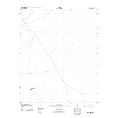
2011 Map of Grand Falls NE
USGS Topo · Published 2011About this map
Wolf Crossing and Tolchico occupy a quiet stretch of the High Desert near the banks of the Little Colorado River in Coconino County. This area of Arizona is characterized by its isolation and the winding path of the river, which has historically served as a critical water source and a geographic anchor for local travel. The presence of Indian Rte 6733 provides a glimpse into the modern infrastructure supporting this rural region, connecting these small points of habitation to the broader landscape. The map's minimalist features suggest a place where the natural watercourse of the Little Colorado remains the most significant feature of the terrain, dictating the placement of early crossings and modern roads.
Find a feature on this map
4 named features on this map. Tap any name to fly to it.
Don’t see what you’re looking for? This feature index may not catch every label — zoom into the map to look around manually.
Map Details
Editions of this 2011 Grand Falls NE Map
This is the sole edition of this map. No revisions or reprints were ever made.
Other maps of this area

1883 · Tusayan
USGS Topo · 1:250,000

1886 · Tusayan
USGS Topo · 1:250,000

1886 · San Francisco Mtns
USGS Topo · 1:250,000

1891 · San Francisco Mtns
USGS Topo · 1:250,000

1894 · San Francisco Mtns
USGS Topo · 1:250,000

1899 · San Francisco Mtns
USGS Topo · 1:250,000

1947 · Flagstaff
USGS Topo · 1:250,000

1954 · Flagstaff
USGS Topo · 1:250,000

1955 · Winslow 2 SW
USGS Topo · 1:24,000

1955 · Grand Falls NE
USGS Topo · 1:24,000