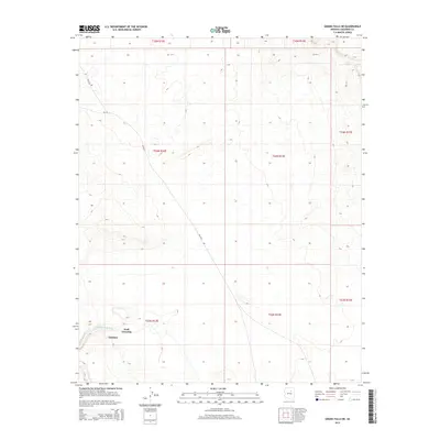
2014 Map of Grand Falls NE
USGS Topo · Published 2014About this map
The Little Colorado River winds through the southwestern corner of this Coconino County terrain, serving as the primary geographical focus in an otherwise open landscape. This 2014 survey captures the modest settlement of Tolchico, positioned near the riverbanks where historical travel and modern infrastructure converge. The presence of Wolf Crossing suggests a longstanding point of transit across the water, a critical junction in this arid environment. Transportation through the area is defined by Bureau of Indian Affairs routes, including Bia-6732 and Bia-70, which provide access to the remote township and surrounding land divisions within the Navaho Indian Reservation. The map detail highlights the sparse but significant human footprint in this part of Arizona, focusing on the essential relationship between water sources and established settlements.
Find a feature on this map
10 named features on this map. Tap any name to fly to it.
Don’t see what you’re looking for? This feature index may not catch every label — zoom into the map to look around manually.
Map Details
Editions of this 2014 Grand Falls NE Map
This is the sole edition of this map. No revisions or reprints were ever made.
Other maps of this area

1883 · Tusayan
USGS Topo · 1:250,000

1886 · Tusayan
USGS Topo · 1:250,000

1886 · San Francisco Mtns
USGS Topo · 1:250,000

1891 · San Francisco Mtns
USGS Topo · 1:250,000

1894 · San Francisco Mtns
USGS Topo · 1:250,000

1899 · San Francisco Mtns
USGS Topo · 1:250,000

1947 · Flagstaff
USGS Topo · 1:250,000

1954 · Flagstaff
USGS Topo · 1:250,000

1955 · Winslow 2 SW
USGS Topo · 1:24,000

1955 · Grand Falls NE
USGS Topo · 1:24,000