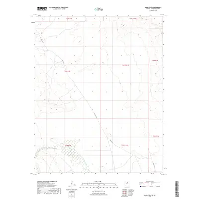
2018 Map of Grand Falls NE
USGS Topo · Published 2018About this map
Tolchico sits on the northern banks of the Little Colorado River in this arid Coconino County landscape. The settlement is positioned within the Navajo Nation, where the river's path creates a distinct riparian break in the high desert terrain. This 2018 survey emphasizes the modern transportation network, centered on Indian Rte 6732 as it traverses the expansive canyon and mesa country. The map detail highlights the complex hydrology of the river basin, tracing its seasonal flows through various townships and ranges including t23n r12e and t24n r12.5e. It captures a specific moment in the rural development of the region, documenting the relationship between tribal infrastructure and the natural geography of the Painted Desert region.
Find a feature on this map
11 named features on this map. Tap any name to fly to it.
Don’t see what you’re looking for? This feature index may not catch every label — zoom into the map to look around manually.
Map Details
Editions of this 2018 Grand Falls NE Map
This is the sole edition of this map. No revisions or reprints were ever made.
Other maps of this area

1883 · Tusayan
USGS Topo · 1:250,000

1886 · Tusayan
USGS Topo · 1:250,000

1886 · San Francisco Mtns
USGS Topo · 1:250,000

1891 · San Francisco Mtns
USGS Topo · 1:250,000

1894 · San Francisco Mtns
USGS Topo · 1:250,000

1899 · San Francisco Mtns
USGS Topo · 1:250,000

1947 · Flagstaff
USGS Topo · 1:250,000

1954 · Flagstaff
USGS Topo · 1:250,000

1955 · Winslow 2 SW
USGS Topo · 1:24,000

1955 · Grand Falls NE
USGS Topo · 1:24,000