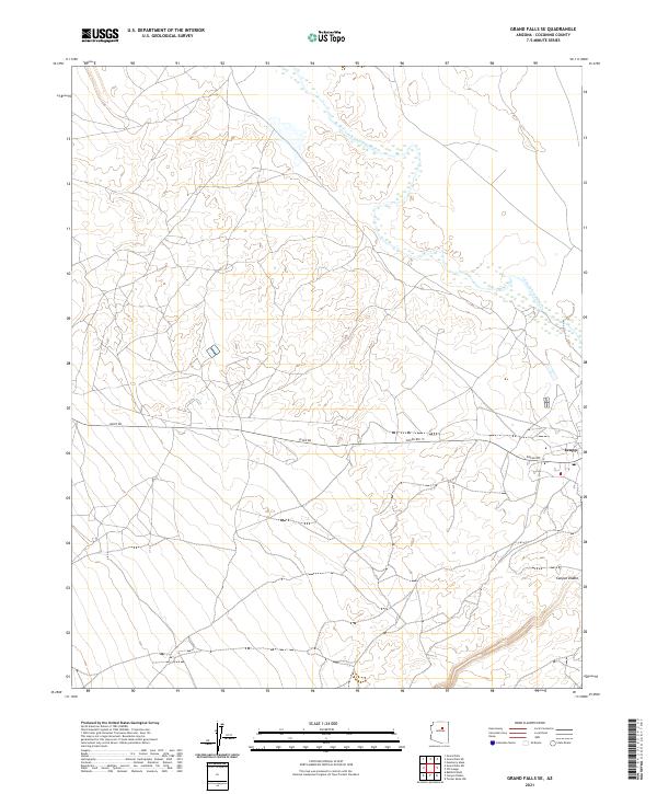
2021 Map of Grand Falls SE
USGS Topo · Published 2021About this map
Leupp stands as a focal point in this high-desert landscape, positioned near the intersection of Leupp Rd and Indian Rte 15. The settlement is situated south of the meandering Little Colorado River, which tracks through the northern reaches of the quadrangle. The terrain is defined by the significant drainage of Canyon Diablo in the southeast, illustrating the complex hydrological systems that carve through Coconino County. This 2021 survey documents the modern infrastructure of the region, showing a network of local connectors and trails that bridge the gap between the river valley and the arid plateaus. The map clearly delineates the Public Land Survey System township and range lines, such as t22n r13e, which provide a critical framework for understanding property and jurisdictional boundaries in this part of Arizona.
Find a feature on this map
12 named features on this map. Tap any name to fly to it.
Don’t see what you’re looking for? This feature index may not catch every label — zoom into the map to look around manually.
Map Details
Editions of this 2021 Grand Falls SE Map
This is the sole edition of this map. No revisions or reprints were ever made.
Other maps of this area

1883 · Tusayan
USGS Topo · 1:250,000

1886 · Tusayan
USGS Topo · 1:250,000

1886 · San Francisco Mtns
USGS Topo · 1:250,000

1891 · San Francisco Mtns
USGS Topo · 1:250,000

1894 · San Francisco Mtns
USGS Topo · 1:250,000

1899 · San Francisco Mtns
USGS Topo · 1:250,000

1947 · Flagstaff
USGS Topo · 1:250,000

1954 · Flagstaff
USGS Topo · 1:250,000

1955 · Winslow 2 SW
USGS Topo · 1:24,000

1955 · Grand Falls NE
USGS Topo · 1:24,000