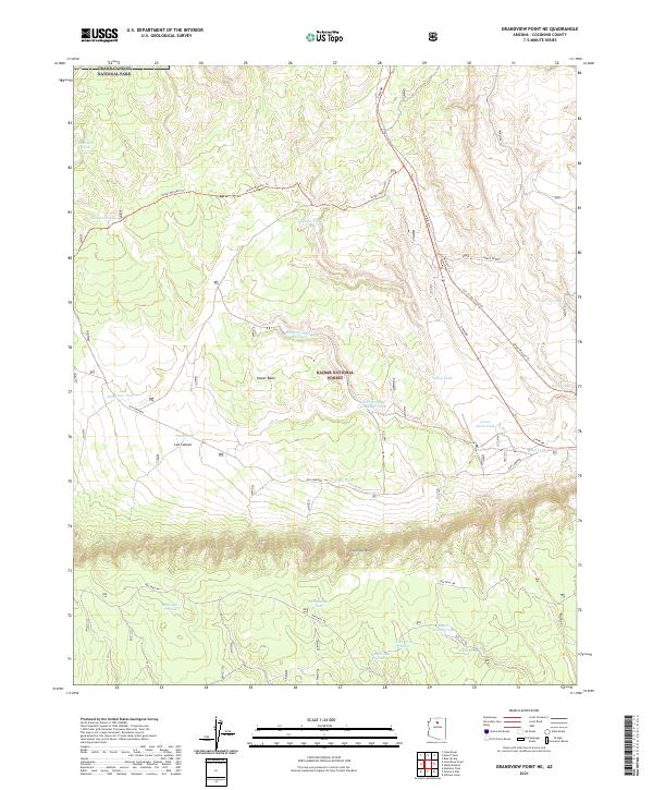
2021 Map of Grandview Point NE
USGS Topo · Published 2021About this map
Coconino Rim dominates the southern landscape of this high-country plateau, marking a significant topographic rise south of the Upper Basin. The region is defined by its integration into Grand Canyon National Park and Kaibab National Forest, showcasing a specialized network of water management through numerous cattle tanks such as Seventy-seven Bar Tank, Bentonite Tank, and Old Hibben Tank. These features represent the essential infrastructure for ranching in an arid environment where natural surface water is scarce.
Find a feature on this map
34 named features on this map. Tap any name to fly to it.
Don’t see what you’re looking for? This feature index may not catch every label — zoom into the map to look around manually.
Map Details
Editions of this 2021 Grandview Point NE Map
This is the sole edition of this map. No revisions or reprints were ever made.
Other maps of this area

1886 · San Francisco Mtns
USGS Topo · 1:250,000

1886 · Echo Cliffs
USGS Topo · 1:250,000

1891 · San Francisco Mtns
USGS Topo · 1:250,000

1891 · Echo Cliffs
USGS Topo · 1:250,000

1894 · San Francisco Mtns
USGS Topo · 1:250,000

1899 · San Francisco Mtns
USGS Topo · 1:250,000

1907 · Vishnu
USGS Topo · 1:48,000

1947 · Flagstaff
USGS Topo · 1:250,000

1954 · Flagstaff
USGS Topo · 1:250,000

1955 · Blue Spring
USGS Topo · 1:62,500