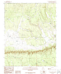
1989 Map of Grandview Point NE
USGS Topo · Published 1989About this map
Grand Canyon National Park borders the northern reaches of this high-altitude landscape, where the dramatic elevation change of the Coconino Rim creates a sharp natural boundary. The terrain is defined by the Upper Basin and its complex network of seasonal drainages, including Lee Canyon and Deer Tank Wash. Human activity in this portion of the Kaibab National Forest is evidenced by a sophisticated system of water catchments, essential for ranching and wildlife in this arid environment. These features range from Old Hibben Tank to more modern installations like the Upper Cabin Tank and various potholes. The presence of the Coconino Rim Road and an isolated Gravel Pit suggest a landscape primarily used for resource management and backcountry access during the late twentieth century.
Find a feature on this map
29 named features on this map. Tap any name to fly to it.
Don’t see what you’re looking for? This feature index may not catch every label — zoom into the map to look around manually.
Map Details
Editions of this 1989 Grandview Point NE Map
This is the sole edition of this map. No revisions or reprints were ever made.
Other maps of this area

1886 · San Francisco Mtns
USGS Topo · 1:250,000

1886 · Echo Cliffs
USGS Topo · 1:250,000

1891 · San Francisco Mtns
USGS Topo · 1:250,000

1891 · Echo Cliffs
USGS Topo · 1:250,000

1894 · San Francisco Mtns
USGS Topo · 1:250,000

1899 · San Francisco Mtns
USGS Topo · 1:250,000

1907 · Vishnu
USGS Topo · 1:48,000

1947 · Flagstaff
USGS Topo · 1:250,000

1954 · Flagstaff
USGS Topo · 1:250,000

1955 · Blue Spring
USGS Topo · 1:62,500