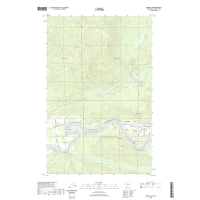
2020 Map of Grandy Lake
USGS Topo · Published 2020About this map
The Skagit Wild and Scenic River carves a deep valley through this Skagit County landscape, serving as the primary corridor for settlements like Grassmere and Cape Horn. To the east, the town of Concrete sits at the confluence of transport and terrain, home to aviation at Mears Field and the resting grounds of Forest Park Cem. The map illustrates a clear transition from the river-level communities and agriculture to the steep elevations of Goat Mtn and Burpee Hill. This area is defined by its water resources, with recreation and drainage systems revolving around Grandy Lake, Lake Tyee, and Vogler Lake. To the south of the river, Finney Creek and Quartz Cr wind through the hills, while the north is navigated via major routes like Baker Lake Rd.
Find a feature on this map
61 named features on this map. Tap any name to fly to it.
Don’t see what you’re looking for? This feature index may not catch every label — zoom into the map to look around manually.
Map Details
Editions of this 2020 Grandy Lake Map
This is the sole edition of this map. No revisions or reprints were ever made.
Other maps of this area

1899 · Stillaguamish
USGS Topo · 1:125,000

1901 · Stilaguamish
USGS Topo · 1:125,000

1909 · Mt Baker
USGS Topo · 1:192,000

1915 · Mt. Baker
USGS Topo · 1:250,000

1952 · Lake Shannon
USGS Topo · 1:62,500

1952 · Hamilton
USGS Topo · 1:62,500

1955 · Concrete
USGS Topo · 1:250,000

1956 · Oso
USGS Topo · 1:62,500

1958 · Concrete
USGS Topo · 1:250,000

1962 · Concrete
USGS Topo · 1:250,000