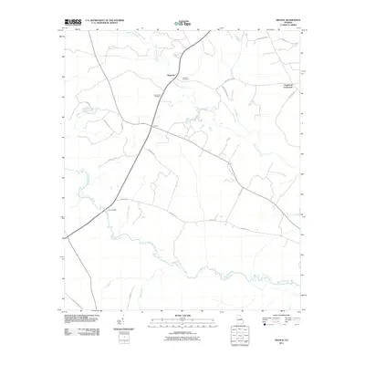
2011 Map of Grange
USGS Topo · Published 2011About this map
Rocky Comfort Creek winds through the central Georgia landscape, anchoring a rural territory defined by scattered settlements and agricultural tradition. The community of Grange sits at the intersection of several local routes, while to the north, Magnolia is served by the Magnolia Cemetery and nearby Providence Cemetery. These burial grounds and small crossroads, such as Stapletons Crossroads, provide essential points of reference for genealogists tracking families in Washington County. In the southern reaches of the quadrangle, the meandering Ogeechee River forms a significant natural boundary, joined by tributaries like Camp Branch and Mill Branch. The crossing at Fenns Bridge highlights a historic point of transit over the river, reflecting the long-established road network that connects these small farming communities.
Find a feature on this map
27 named features on this map. Tap any name to fly to it.
Don’t see what you’re looking for? This feature index may not catch every label — zoom into the map to look around manually.
Map Details
Editions of this 2011 Grange Map
This is the sole edition of this map. No revisions or reprints were ever made.
Other maps of this area

1920 · Stapleton
USGS Topo · 1:62,500

1948 · Stapleton
USGS Topo · 1:62,500

1948 · Louisville
USGS Topo · 1:24,000

1950 · Louisville
USGS Topo · 1:24,000

1950 · Wrens
USGS Topo · 1:24,000

1953 · Athens
USGS Topo · 1:250,000

1957 · Macon
USGS Topo · 1:250,000

1958 · Macon
USGS Topo · 1:250,000

1958 · Athens
USGS Topo · 1:250,000

1959 · Athens
USGS Topo · 1:250,000