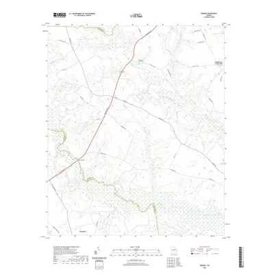
2020 Map of Grange
USGS Topo · Published 2020About this map
The Ogeechee River defines the southern boundary of this landscape where the borders of Washington, Jefferson, and Glascock counties converge. In this rural pocket of Georgia, the small settlement of Grange sits at a central junction of Grange Rd and Fenns Bridge Rd, surrounded by land drained by Rocky Comfort Cr and its tributaries like Ivey Br. To the north, Stapletons Crossroads marks a distinct intersection of local routes, while the northern edge of Davisboro appears at the southern map margin. For local historians and genealogists, the placement of Magnolia Church Cem and Providence Church Cem provides essential points of reference for tracing family lineages and early community centers in this river-and-creek-defined territory.
Find a feature on this map
39 named features on this map. Tap any name to fly to it.
Don’t see what you’re looking for? This feature index may not catch every label — zoom into the map to look around manually.
Map Details
Editions of this 2020 Grange Map
This is the sole edition of this map. No revisions or reprints were ever made.
Other maps of this area

1920 · Stapleton
USGS Topo · 1:62,500

1948 · Stapleton
USGS Topo · 1:62,500

1948 · Louisville
USGS Topo · 1:24,000

1950 · Louisville
USGS Topo · 1:24,000

1950 · Wrens
USGS Topo · 1:24,000

1953 · Athens
USGS Topo · 1:250,000

1957 · Macon
USGS Topo · 1:250,000

1958 · Macon
USGS Topo · 1:250,000

1958 · Athens
USGS Topo · 1:250,000

1959 · Athens
USGS Topo · 1:250,000