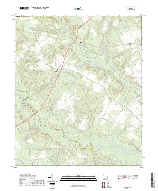
2024 Map of Grange
USGS Topo · Published 2024About this map
The Ogeechee River and its winding tributaries define the landscape of this Jefferson County quadrangle, marking the borders between Glascock and Washington counties. This modern survey illustrates a rural Georgia landscape where family lineages are etched into the road network, seen in names like Alonzo Davis Rd and Jasper Davis Rd. The transition between the upper coastal plain and the piedmont is visible near the Fall Line Fwy, which cuts across the southwest corner of the sheet.
Find a feature on this map
34 named features on this map. Tap any name to fly to it.
Don’t see what you’re looking for? This feature index may not catch every label — zoom into the map to look around manually.
Map Details
Editions of this 2024 Grange Map
This is the sole edition of this map. No revisions or reprints were ever made.
Other maps of this area

1920 · Stapleton
USGS Topo · 1:62,500

1948 · Stapleton
USGS Topo · 1:62,500

1948 · Louisville
USGS Topo · 1:24,000

1950 · Louisville
USGS Topo · 1:24,000

1950 · Wrens
USGS Topo · 1:24,000

1953 · Athens
USGS Topo · 1:250,000

1957 · Macon
USGS Topo · 1:250,000

1958 · Macon
USGS Topo · 1:250,000

1958 · Athens
USGS Topo · 1:250,000

1959 · Athens
USGS Topo · 1:250,000