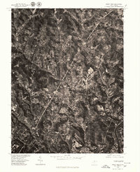
1976 Map of Grant Town
USGS Topo · Published 1979About this map
Grant Town and the surrounding coal-country settlements of Marion County are captured in this mid-1970s orthophotograph. The aerial imagery highlights the distinct development patterns of communities like Fairview, Barrackville, and Farmington, where the winding valleys of northern West Virginia dictate the layout of roads and housing. This specialized survey, produced in cooperation with the Soil Conservation Service, provides a detailed visual record of the land use before significant late-century modernization. To the southeast, the Monongahela River flows past Rivesville and the outskirts of Fairmont, revealing the industrial and transport arteries that shaped the region. Small rural hamlets such as Mc Curdyville sit nestled in the higher elevations, illustrating the contrast between the dense river-valley towns and the more dispersed upland farmsteads.
Find a feature on this map
8 named features on this map. Tap any name to fly to it.
Don’t see what you’re looking for? This feature index may not catch every label — zoom into the map to look around manually.
Map Details
Editions of this 1976 Grant Town Map
This is the sole edition of this map. No revisions or reprints were ever made.
Other maps of this area

1902 · Clarksburg
USGS Topo · 1:62,500

1902 · Fairmont
USGS Topo · 1:62,500

1904 · Blacksville
USGS Topo · 1:62,500

1905 · Mannington
USGS Topo · 1:62,500

1910 · Clarksburg
USGS Topo · 1:62,500

1923 · Blacksville
USGS Topo · 1:62,500

1923 · Fairmont
USGS Topo · 1:62,500

1923 · Mannington
USGS Topo · 1:62,500

1923 · Clarksburg
USGS Topo · 1:62,500

1925 · Blacksville
USGS Topo · 1:62,500