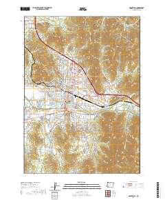
2020 Map of Grants Pass
USGS Topo · Published 2020About this map
The Rogue River defines the southern heart of Grants Pass, where the iconic Caveman Bridge spans the water near the city center. This 2020 map details the urban grid and expanding residential fringes, showing the proximity of the Josephine County Courthouse to the main commercial district. The landscape transitions quickly from the valley floor to prominent peaks like Dollar Mtn and Bald Mtn, with the Central Oregon & Pacific RR threading through the northern reaches of the city. Water management is evident through the winding path of the Tokay Canal and the S Main Canal, which support the outlying community of Fruitdale. Several significant interment sites, including Hillcrest Memorial Park Cem and Granite Hill Cem, provide important landmarks for local history and genealogical research.
Find a feature on this map
159 named features on this map. Tap any name to fly to it.
Don’t see what you’re looking for? This feature index may not catch every label — zoom into the map to look around manually.
Map Details
Editions of this 2020 Grants Pass Map
This is the sole edition of this map. No revisions or reprints were ever made.
Other maps of this area

1904 · Riddle
USGS Topo · 1:125,000

1908 · Grants Pass
USGS Topo · 1:125,000

1954 · Glendale
USGS Topo · 1:62,500

1954 · Gold Hill
USGS Topo · 1:62,500

1954 · Wimer
USGS Topo · 1:62,500

1954 · Grants Pass
USGS Topo · 1:62,500

1955 · Medford
USGS Topo · 1:250,000

1957 · Medford
USGS Topo · 1:250,000

1958 · Medford
USGS Topo · 1:250,000

1974 · Grants Pass NW
USGS Topo · 1:24,000