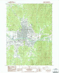
1986 Map of Grants Pass
USGS Topo · Published 1986About this map
Grants Pass serves as the central hub of this 1980s landscape, positioned where the Rogue River flows between the steep rising slopes of Dollar Mountain and Baldy Mountain. The urban grid reflects mid-century expansion with residential areas like Westholm Park and Lawnridge Park established north of the river, while the County Fairgrounds and a Drive-in Theater mark the western edge of town. For local historians, the Croxton Pioneer Memorial Park and several local quarries provide evidence of the area's early settlement and industry.
Find a feature on this map
51 named features on this map. Tap any name to fly to it.
Don’t see what you’re looking for? This feature index may not catch every label — zoom into the map to look around manually.
Map Details
Editions of this 1986 Grants Pass Map
This is the sole edition of this map. No revisions or reprints were ever made.
Other maps of this area

1904 · Riddle
USGS Topo · 1:125,000

1908 · Grants Pass
USGS Topo · 1:125,000

1954 · Glendale
USGS Topo · 1:62,500

1954 · Gold Hill
USGS Topo · 1:62,500

1954 · Wimer
USGS Topo · 1:62,500

1954 · Grants Pass
USGS Topo · 1:62,500

1955 · Medford
USGS Topo · 1:250,000

1957 · Medford
USGS Topo · 1:250,000

1958 · Medford
USGS Topo · 1:250,000

1974 · Grants Pass NW
USGS Topo · 1:24,000