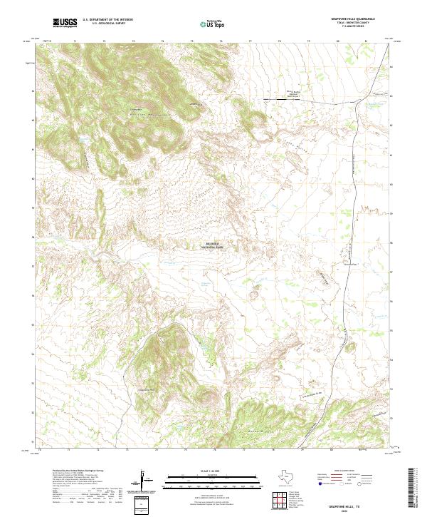
2022 Map of Grapevine Hills
USGS Topo · Published 2022About this map
Big Bend National Park dominates this desert landscape, where the dramatic elevation changes of the Rosillos Mountains meet the vast drainage systems of the Chihuahuan Desert. Significant peaks such as Choate Mtn and Angela Peak tower over the Canoe Valley, while the eponymous Grapevine Hills provide a distinctive geological formation to the south. Water is the primary architect and lifeblood of this arid region, evidenced by the numerous seasonal drainages like Tornillo Cr and Cottonwood Draw. The map records essential water sources for both wildlife and historic ranching operations, including Grapevine Springs, Neville Spring, and the isolated Mailbox Tank. Access through this remote terrain is primarily maintained via Persimmon Gap Road, which traverses the Tornillo Flat near Exhibit Ridge.
Find a feature on this map
25 named features on this map. Tap any name to fly to it.
Don’t see what you’re looking for? This feature index may not catch every label — zoom into the map to look around manually.
Map Details
Editions of this 2022 Grapevine Hills Map
This is the sole edition of this map. No revisions or reprints were ever made.
Other maps of this area

1903 · Chisos Mountains
USGS Topo · 1:125,000

1905 · Chisos Mountains
USGS Topo · 1:125,000

1917 · Bone Spring
USGS Topo · 1:62,500

1918 · Bone Spring
USGS Topo · 1:125,000

1918 · Bone Spring
USGS Topo · 1:62,500

1918 · Nine Point Mesa
USGS Topo · 1:62,500

1920 · Bone Spring
USGS Topo · 1:62,500

1937 · Nine Point Mesa
USGS Topo · 1:62,500

1959 · Emory Peak
USGS Topo · 1:250,000

1965 · Emory Peak
USGS Topo · 1:250,000