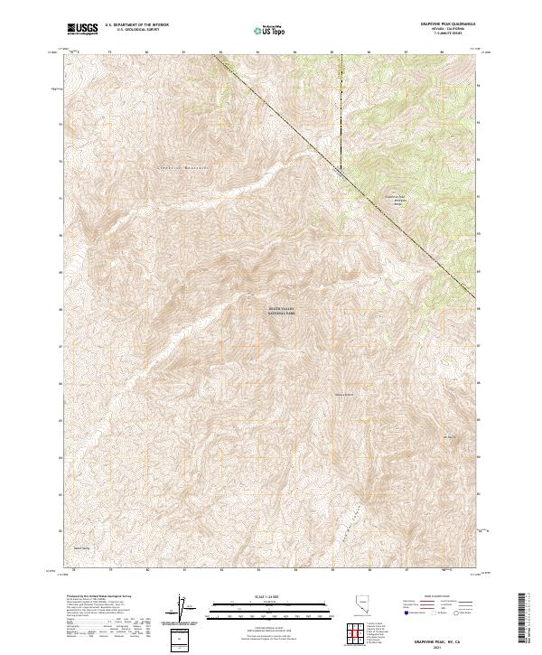
2021 Map of Grapevine Peak
USGS Topo · Published 2021About this map
Death Valley National Park dominates this high-altitude section of the Nevada-California border, where the Great Basin meets the northern reaches of the Mojave Desert. The map is defined by the high elevations of the Grapevine Mountains, specifically the summit of Grapevine Peak in the Amargosa Range. This area represents a critical boundary zone where Esmeralda and Nye counties in Nevada meet Inyo County in California. The dramatic relief of the land is illustrated by the deep descent into Red Wall Canyon and the transition toward the low-lying floor of Death Valley at the southwestern corner. Further east, Mt Palmer provides another prominent landmark in this desert landscape, documenting the topography of the borderlands long after the initial surveying of the regional township and range lines.
Find a feature on this map
17 named features on this map. Tap any name to fly to it.
Don’t see what you’re looking for? This feature index may not catch every label — zoom into the map to look around manually.
Map Details
Editions of this 2021 Grapevine Peak Map
This is the sole edition of this map. No revisions or reprints were ever made.
Other maps of this area

1908 · Lida
USGS Topo · 1:250,000

1908 · Ballarat
USGS Topo · 1:250,000

1913 · Lida
USGS Topo · 1:250,000

1913 · Ballarat
USGS Topo · 1:250,000

1948 · Death Valley
USGS Topo · 1:250,000

1954 · Death Valley
USGS Topo · 1:250,000

1954 · Goldfield
USGS Topo · 1:250,000

1955 · Goldfield
USGS Topo · 1:250,000

1956 · Death Valley
USGS Topo · 1:250,000

1957 · Death Valley
USGS Topo · 1:250,000