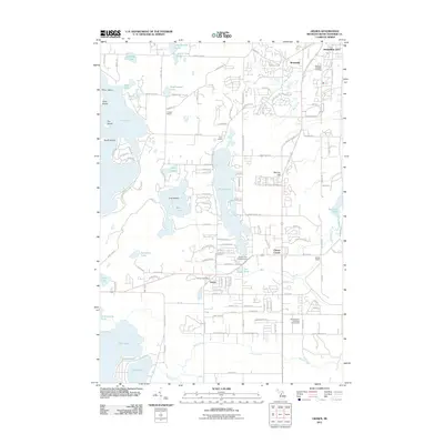
2011 Map of Grawn
USGS Topo · Published 2011About this map
Grawn and the nearby Chums Corner junction serve as focal points in this lakeside landscape southwest of Traverse City. The region is defined by a dense concentration of glacial lakes and ponds, ranging from the expansive Long Lake and Duck Lake to smaller basins like Saunders Lake and Ellis Lake. This 2011 survey illustrates a community deeply integrated with its geography, where residential developments follow the contours of the shoreline and historic local institutions remain prominent. Educational sites such as the Howard School, Dunn School, and Beitner School are positioned alongside significant public spaces including the Northwestern Michigan Fairgrounds. The eastern edge of the quadrangle is marked by the winding course of the Boardman River near Keystone Pond, while local history is anchored by the Grawn Post Office and the Memorial Gardens Cemetery near Brookside.
Find a feature on this map
141 named features on this map. Tap any name to fly to it.
Don’t see what you’re looking for? This feature index may not catch every label — zoom into the map to look around manually.
Map Details
Editions of this 2011 Grawn Map
This is the sole edition of this map. No revisions or reprints were ever made.
Other maps of this area

1954 · Traverse City
USGS Topo · 1:250,000

1956 · Kingsley
USGS Topo · 1:62,500

1956 · Thompsonville
USGS Topo · 1:62,500

1957 · Traverse City
USGS Topo · 1:62,500

1957 · Maple City
USGS Topo · 1:62,500

1958 · Traverse City
USGS Topo · 1:250,000

1976 · Thompsonville NE
USGS Topo · 1:24,000

1976 · Thompsonville SE
USGS Topo · 1:24,000

1983 · Maple City
USGS Topo · 1:24,000

1983 · Buckley
USGS Topo · 1:25,000
Featured Places
- Garfield Charter Township, Garfield Township
- Garfield Township, MI
- Traverse City, MI
- Long Lake Township, MI
- Blair Township, MI