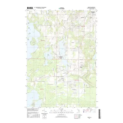
2017 Map of Grawn
USGS Topo · Published 2017About this map
Grawn and Brookside serve as primary hubs within this glacial lake landscape just southwest of Traverse City. The area is defined by a dense concentration of water bodies, ranging from the large expanses of Long Lake and Silver Lake to smaller basins like Yonkers Lake and Saunders Lake. These natural features, combined with the presence of the Manistee National Forest, indicate a region where residential expansion and recreational land use intersect.
Find a feature on this map
48 named features on this map. Tap any name to fly to it.
Don’t see what you’re looking for? This feature index may not catch every label — zoom into the map to look around manually.
Map Details
Editions of this 2017 Grawn Map
This is the sole edition of this map. No revisions or reprints were ever made.
Other maps of this area

1954 · Traverse City
USGS Topo · 1:250,000

1956 · Kingsley
USGS Topo · 1:62,500

1956 · Thompsonville
USGS Topo · 1:62,500

1957 · Traverse City
USGS Topo · 1:62,500

1957 · Maple City
USGS Topo · 1:62,500

1958 · Traverse City
USGS Topo · 1:250,000

1976 · Thompsonville NE
USGS Topo · 1:24,000

1976 · Thompsonville SE
USGS Topo · 1:24,000

1983 · Maple City
USGS Topo · 1:24,000

1983 · Buckley
USGS Topo · 1:25,000
Featured Places
- Garfield Charter Township, Garfield Township
- Garfield Township, MI
- Traverse City, MI
- Long Lake Township, MI
- Blair Township, MI