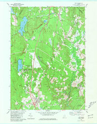
1980 Map of Gray
USGS Topo · Published 1981About this map
Shaker Village stands on the northwestern shores of Sabbathday Pond, representing a preserved pocket of communal history in this part of Cumberland County. The landscape is a complex network of water and wetlands, defined by the Royal River and its many tributaries like Collyer Brook and Brandy Brook. Development patterns reflect the era's infrastructure, with the Maine Turnpike cutting through the center and the Canadian National and Maine Central railroads serving the eastern corridors near New Gloucester Station and Intervale.
Find a feature on this map
74 named features on this map. Tap any name to fly to it.
Don’t see what you’re looking for? This feature index may not catch every label — zoom into the map to look around manually.
Map Details
Editions of this 1980 Gray Map
3 editions found
Other maps of this area

1892 · Freeport
USGS Topo · 1:62,500

1894 · Gray
USGS Topo · 1:62,500

1898 · Gray
USGS Topo · 1:62,500

1908 · Poland
USGS Topo · 1:62,500

1908 · Lewiston
USGS Topo · 1:62,500

1940 · Poland
USGS Topo · 1:62,500

1941 · Freeport
USGS Topo · 1:62,500

1942 · Lewiston
USGS Topo · 1:62,500

1942 · Poland
USGS Topo · 1:62,500

1942 · Gray
USGS Topo · 1:62,500