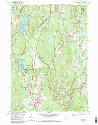
1980 Map of Gray
USGS Topo · Published 1989About this map
Shaker Village anchors the northwest corner of this 1980 survey, overlooking the waters of Sabbathday Pond. This landscape in Cumberland County illustrates a transition from agrarian roots to modern infrastructure, where the Maine Turnpike and its Interchange 11 cut through the traditional village centers of Gray and New Gloucester. The map documents a complex mix of community institutions and industrial operations, ranging from the sprawling Pineland Hospital and Training Center near the Royal River to the Dry Mills Fish Hatchery and Game Farm. Rail history is well-represented by the parallel tracks of the Maine Central and Canadian National railroads, which served early hubs like New Gloucester Station and Intervale. Numerous gravel pits and small ponds like Lily Pond and Crystal Lake dot the terrain between ridges such as Gloucester Hill and Colley Hill.
Find a feature on this map
64 named features on this map. Tap any name to fly to it.
Don’t see what you’re looking for? This feature index may not catch every label — zoom into the map to look around manually.
Map Details
Editions of this 1980 Gray Map
3 editions found
Other maps of this area

1892 · Freeport
USGS Topo · 1:62,500

1894 · Gray
USGS Topo · 1:62,500

1898 · Gray
USGS Topo · 1:62,500

1908 · Poland
USGS Topo · 1:62,500

1908 · Lewiston
USGS Topo · 1:62,500

1940 · Poland
USGS Topo · 1:62,500

1941 · Freeport
USGS Topo · 1:62,500

1942 · Lewiston
USGS Topo · 1:62,500

1942 · Poland
USGS Topo · 1:62,500

1942 · Gray
USGS Topo · 1:62,500