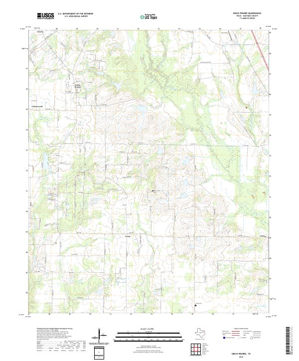
2022 Map of Grays Prairie
USGS Topo · Published 2022About this map
Grays Prairie and the surrounding Kaufman County landscape are defined by a network of creeks and small settlements that maintain a rural character into the twenty-first century. The area is intersected by numerous drainage systems, most notably Kings Cr and Little Cottonwood Cr, which feed into the local hydrology alongside Vaughn Lake and Coffee Lake. The map reveals a high density of named country roads and ranch lanes, such as Sellmeyer Ln and Sandy Ridge Rd, reflecting the parcelled nature of the Texas prairie. Cultural and genealogical landmarks are preserved in the form of the Pyle Prairie Cem and Shiloh Cem, which sit alongside established communities like Scurry, Cottonwood, and Lively. This survey captures the region just west of Kemp, showing how modern infrastructure such as Erco Field and the FM 148 corridor integrates with the historical agricultural footprint of the prairie.
Find a feature on this map
89 named features on this map. Tap any name to fly to it.
Don’t see what you’re looking for? This feature index may not catch every label — zoom into the map to look around manually.
Map Details
Editions of this 2022 Grays Prairie Map
This is the sole edition of this map. No revisions or reprints were ever made.
Other maps of this area

1920 · Kemp
USGS Topo · 1:62,500

1954 · Dallas
USGS Topo · 1:250,000

1956 · Kaufman
USGS Topo · 1:62,500

1957 · Kemp
USGS Topo · 1:62,500

1958 · Dallas
USGS Topo · 1:250,000

1960 · Tool
USGS Topo · 1:24,000

1960 · Grays Prairie
USGS Topo · 1:24,000

1961 · Kemp
USGS Topo · 1:24,000

1962 · Rosser SW
USGS Topo · 1:24,000
1962 · Styx
USGS Topo · 1:24,000