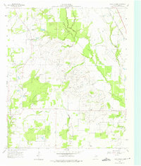
1960 Map of Grays Prairie
USGS Topo · Published 1975About this map
Grays Prairie and the surrounding agricultural landscape of Kaufman County are defined by a network of seasonal watercourses and rural gathering points in the early 1960s. The terrain is marked by the winding paths of Kings Creek and Cottonwood Creek, which drain toward the south through a mix of open prairie and wooded creek bottoms. Small community centers like Lively and Stubbs anchor the local road system, while several rural churches, including Pyles Prairie Ch and Shady Grove Ch, serve as significant landmarks for genealogists tracing family roots in this part of Texas. A prominent Pipeline cuts diagonally across the northern section, contrasting with the older transportation infrastructure of the Texas and New Orleans (Southern Pacific) railroad. The presence of a Gravel Pit near the southern boundary suggests local extractive industry amidst the predominantly rural, creek-divided land.
Find a feature on this map
13 named features on this map. Tap any name to fly to it.
Don’t see what you’re looking for? This feature index may not catch every label — zoom into the map to look around manually.
Map Details
Editions of this 1960 Grays Prairie Map
Other maps of this area

1920 · Kemp
USGS Topo · 1:62,500

1954 · Dallas
USGS Topo · 1:250,000

1956 · Kaufman
USGS Topo · 1:62,500

1957 · Kemp
USGS Topo · 1:62,500

1958 · Dallas
USGS Topo · 1:250,000

1960 · Tool
USGS Topo · 1:24,000

1960 · Grays Prairie
USGS Topo · 1:24,000

1961 · Kemp
USGS Topo · 1:24,000

1962 · Rosser SW
USGS Topo · 1:24,000
1962 · Styx
USGS Topo · 1:24,000