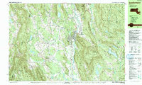
1987 Map of Great Barrington
USGS Topo · Published 1988About this map
The Housatonic River winds through this 1980s landscape, anchoring the commercial and civic life of Great Barrington. This era shows a community balancing its industrial past along the Boston and Maine Railroad with growing institutional roles, marked by the presence of Fairview Hosp and the campus of Simons Rock Bard College. Smaller settlements like Van Deusenville and Risingdale line the river valley, while the western reaches include the distinct hamlets of North Egremont and South Egremont. Significant protected lands are visible, from the Monument Mountain Reservation to the high peaks of Beartown Mountain. The inclusion of the Appalachian Trail crossing through East Mountain State Forest highlights the region's enduring character as a destination for outdoor recreation and conservation near the Columbia Co border.
Find a feature on this map
108 named features on this map. Tap any name to fly to it.
Don’t see what you’re looking for? This feature index may not catch every label — zoom into the map to look around manually.
Map Details
Editions of this 1987 Great Barrington Map
This is the sole edition of this map. No revisions or reprints were ever made.
Other maps of this area

1885 · Sheffield
USGS Topo · 1:62,500

1886 · Becket
USGS Topo · 1:62,500

1888 · Sheffield
USGS Topo · 1:62,500

1888 · Becket
USGS Topo · 1:62,500

1888 · Sandisfield
USGS Topo · 1:62,500

1888 · Pittsfield
USGS Topo · 1:62,500

1890 · Pittsfield
USGS Topo · 1:62,500

1891 · Sheffield
USGS Topo · 1:62,500

1893 · Becket
USGS Topo · 1:62,500

1893 · Sheffield
USGS Topo · 1:62,500