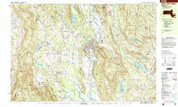
1997 Map of Great Barrington
USGS Topo · Published 1999About this map
The Housatonic River winds through the heart of the Berkshires, anchoring a landscape where agricultural plains meet steep conservation land. This late-century survey of Great Barrington and its surrounding villages, including North Egremont and South Egremont, illustrates a region deeply connected to its natural geography and academic institutions. The presence of Simons Rock Bard College and the Great Barrington Airport suggests a modern evolution of these historic settlements.
Find a feature on this map
100 named features on this map. Tap any name to fly to it.
Don’t see what you’re looking for? This feature index may not catch every label — zoom into the map to look around manually.
Map Details
Editions of this 1997 Great Barrington Map
This is the sole edition of this map. No revisions or reprints were ever made.
Other maps of this area

1885 · Sheffield
USGS Topo · 1:62,500

1886 · Becket
USGS Topo · 1:62,500

1888 · Sheffield
USGS Topo · 1:62,500

1888 · Becket
USGS Topo · 1:62,500

1888 · Sandisfield
USGS Topo · 1:62,500

1888 · Pittsfield
USGS Topo · 1:62,500

1890 · Pittsfield
USGS Topo · 1:62,500

1891 · Sheffield
USGS Topo · 1:62,500

1893 · Becket
USGS Topo · 1:62,500

1893 · Sheffield
USGS Topo · 1:62,500