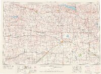
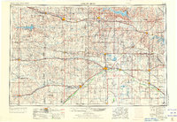
1955 Map of Great Bend
USGS Topo · Published 1966About this map
The Arkansas River and Smoky Hill River define the hydraulic character of Central Kansas in this mid-century survey. Major regional centers such as Hays, Great Bend, and Larned are shown during a period of significant infrastructural development, particularly in water management and energy production. The presence of numerous Oil Field symbols across Barton County, Russell County, and Ellis County highlights the intense petroleum activity that fueled the local economy. Large-scale reservoirs, including Wilson Reservoir and Kanopolis Reservoir, appear alongside natural features like the Salt Marsh within the Quivira National Wildlife Refuge.
Find a feature on this map
181 named features on this map. Tap any name to fly to it.
Don’t see what you’re looking for? This feature index may not catch every label — zoom into the map to look around manually.
Map Details
Editions of this 1955 Great Bend Map
3 editions found

Other maps of this area

1889 · Cheney
USGS Topo · 1:125,000

1889 · Larned
USGS Topo · 1:125,000

1889 · Kinsley
USGS Topo · 1:125,000

1891 · Great Bend
USGS Topo · 1:125,000

1891 · Larned
USGS Topo · 1:125,000

1891 · Hutchinson
USGS Topo · 1:125,000

1891 · Cheney
USGS Topo · 1:125,000

1892 · Ness
USGS Topo · 1:125,000

1892 · Kinsley
USGS Topo · 1:125,000

1892 · Salina
USGS Topo · 1:125,000