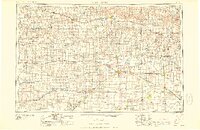
1958 Map of Great Bend
USGS Topo · Published 1958About this map
Great Bend and the surrounding central Kansas plains are defined by an intensive petroleum economy and a landscape shaped by three major river systems in the late 1950s. The Arkansas River flows through the southern reaches, while the Smoky Hill River and Saline River traverse the northern counties. The era's industrial footprint is visible through the density of oil production centers like the Chase-Silica Oil Field and the Bemis-Shutts Oil Field. Water management is prominent with the presence of the Kanopolis Reservoir and Cedar Bluff Reservoir, which were relatively new additions to the landscape at the time of this compilation.
Find a feature on this map
146 named features on this map. Tap any name to fly to it.
Don’t see what you’re looking for? This feature index may not catch every label — zoom into the map to look around manually.
Map Details
Editions of this 1958 Great Bend Map
2 editions found

Other maps of this area

1889 · Cheney
USGS Topo · 1:125,000

1889 · Larned
USGS Topo · 1:125,000

1889 · Kinsley
USGS Topo · 1:125,000

1891 · Great Bend
USGS Topo · 1:125,000

1891 · Larned
USGS Topo · 1:125,000

1891 · Hutchinson
USGS Topo · 1:125,000

1891 · Cheney
USGS Topo · 1:125,000

1892 · Ness
USGS Topo · 1:125,000

1892 · Kinsley
USGS Topo · 1:125,000

1892 · Salina
USGS Topo · 1:125,000