
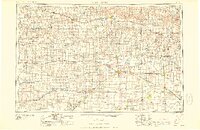
1958 Map of Great Bend
USGS Topo · Published 1958About this map
The Arkansas River and Smoky Hill River dominate this mid-century portrait of Central Kansas, where agriculture and early infrastructure converge across the High Plains. The landscape is marked by significant engineering projects of the era, including the Cedar Bluff Dam and Kanopolis Dam, which created the large reservoirs seen at the western and eastern edges. Historical military presence is preserved through labels for Fort Larned and Fort Zarah, key points along older westward routes that evolved into the modern rail and road networks shown here.
Find a feature on this map
167 named features on this map. Tap any name to fly to it.
Don’t see what you’re looking for? This feature index may not catch every label — zoom into the map to look around manually.
Map Details
Editions of this 1958 Great Bend Map
2 editions found
Other maps of this area

1889 · Cheney
USGS Topo · 1:125,000

1889 · Larned
USGS Topo · 1:125,000

1889 · Kinsley
USGS Topo · 1:125,000

1891 · Great Bend
USGS Topo · 1:125,000

1891 · Larned
USGS Topo · 1:125,000

1891 · Hutchinson
USGS Topo · 1:125,000

1891 · Cheney
USGS Topo · 1:125,000

1892 · Ness
USGS Topo · 1:125,000

1892 · Kinsley
USGS Topo · 1:125,000

1892 · Salina
USGS Topo · 1:125,000