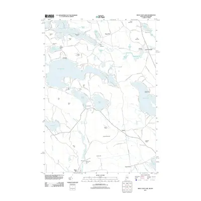
2011 Map of Great East Lake
USGS Topo · Published 2011About this map
Great East Lake straddles the border of Maine and New Hampshire, serving as the central hub for a landscape defined by glacial lakes and the headwaters of the Salmon Falls River. This 2011 survey illustrates the development of lakeside communities and recreation, from Lake Ivanhoe Beach and Great East Lake Beach to the Square Pond Seaplane Base. The terrain is punctuated by significant hills like Bond Mountain and Gile Mountain, while the hydrology is managed through a series of structures including the Great East Lake Dam, Shapleigh Pond Dam, and Horn Pond Dam.
Find a feature on this map
148 named features on this map. Tap any name to fly to it.
Don’t see what you’re looking for? This feature index may not catch every label — zoom into the map to look around manually.
Map Details
Editions of this 2011 Great East Lake Map
This is the sole edition of this map. No revisions or reprints were ever made.
Other maps of this area

1891 · Berwick
USGS Topo · 1:62,500

1891 · Newfield
USGS Topo · 1:62,500

1893 · Berwick
USGS Topo · 1:62,500

1893 · Newfield
USGS Topo · 1:62,500

1919 · Alton
USGS Topo · 1:62,500

1928 · Wolfeboro
USGS Topo · 1:62,500

1933 · Berwick
USGS Topo · 1:48,000

1933 · Newfield
USGS Topo · 1:48,000

1937 · Newfield
USGS Topo · 1:62,500

1937 · Berwick
USGS Topo · 1:62,500