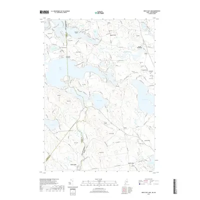
2018 Map of Great East Lake
USGS Topo · Published 2018About this map
Great East Lake straddles the boundary between Maine and New Hampshire, serving as the central geographic feature of a landscape defined by glacial ponds and shifting ridgelines. To the south, the settlement of Milton Mills sits along the Salmon Falls River, which forms a natural border separating Carroll and Strafford counties. The terrain is marked by numerous family and community burial grounds, including the Highland Grove Cem and Maple Grove Cem, reflecting the deep-rooted local history of towns like North Shapleigh and South Acton. The northern reaches are characterized by the Little Ossipee River and smaller water bodies such as Swan Pond and Lake Ivanhoe. Small-scale aviation is represented by Nadeau's Airport near Gerrish Mtn, while recreational history is evident at Great East Lake Beach, showcasing the region's enduring appeal as a woodland retreat.
Find a feature on this map
138 named features on this map. Tap any name to fly to it.
Don’t see what you’re looking for? This feature index may not catch every label — zoom into the map to look around manually.
Map Details
Editions of this 2018 Great East Lake Map
This is the sole edition of this map. No revisions or reprints were ever made.
Other maps of this area

1891 · Berwick
USGS Topo · 1:62,500

1891 · Newfield
USGS Topo · 1:62,500

1893 · Berwick
USGS Topo · 1:62,500

1893 · Newfield
USGS Topo · 1:62,500

1919 · Alton
USGS Topo · 1:62,500

1928 · Wolfeboro
USGS Topo · 1:62,500

1933 · Berwick
USGS Topo · 1:48,000

1933 · Newfield
USGS Topo · 1:48,000

1937 · Newfield
USGS Topo · 1:62,500

1937 · Berwick
USGS Topo · 1:62,500