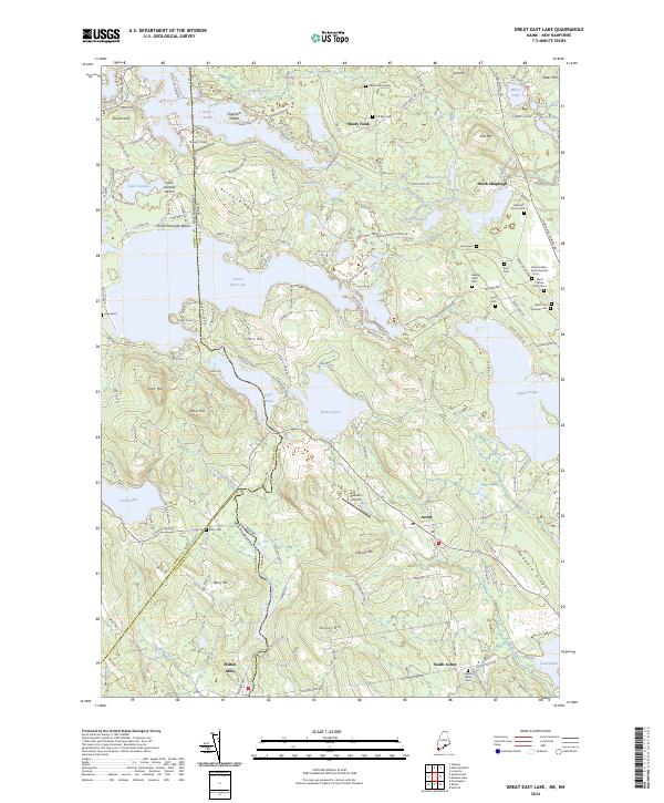
2024 Map of Great East Lake
USGS Topo · Published 2024About this map
Great East Lake and a complex network of glacial water bodies dominate this borderland landscape between York County, Maine, and Carroll County, New Hampshire. The terrain is defined by prominent elevations such as Gerrish Mtn and Hubbard Ridge, which hem in a series of interconnected lakes and ponds including Wilson Lake, Horn Pond, and Lovell Lake. The southern portion of the map centers on the industrial and residential heritage of Milton Mills and South Acton, where the Salmon Falls River and Miller Brook carved pathways for early settlement.
Find a feature on this map
146 named features on this map. Tap any name to fly to it.
Don’t see what you’re looking for? This feature index may not catch every label — zoom into the map to look around manually.
Map Details
Editions of this 2024 Great East Lake Map
This is the sole edition of this map. No revisions or reprints were ever made.
Other maps of this area

1891 · Berwick
USGS Topo · 1:62,500

1891 · Newfield
USGS Topo · 1:62,500

1893 · Berwick
USGS Topo · 1:62,500

1893 · Newfield
USGS Topo · 1:62,500

1919 · Alton
USGS Topo · 1:62,500

1928 · Wolfeboro
USGS Topo · 1:62,500

1933 · Berwick
USGS Topo · 1:48,000

1933 · Newfield
USGS Topo · 1:48,000

1937 · Newfield
USGS Topo · 1:62,500

1937 · Berwick
USGS Topo · 1:62,500