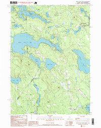
1995 Map of Great East Lake
USGS Topo · Published 1999About this map
The Salmon Falls River and the Little Ossipee River drain a complex landscape of glacial lakes and ridges along the New Hampshire and Maine border. This mid-1990s survey highlights the rural character of the region, where small settlements like Milton Mills and North Shapleigh serve as local hubs connected by winding routes like Perkins Hill Road and Jug Hill Road. The area is defined by its extensive water bodies, including the massive Great East Lake and Square Pond, which are punctuated by landmarks like Shepherd Island and the heights of Gile Mtn. Evidence of local industry and infrastructure is visible through scattered gravel pits, the Mellon Airport near Acton, and the Maple Grove Ch in the south. The map captures a transition where the border between Carroll and York counties meets the winding river valleys.
Find a feature on this map
66 named features on this map. Tap any name to fly to it.
Don’t see what you’re looking for? This feature index may not catch every label — zoom into the map to look around manually.
Map Details
Editions of this 1995 Great East Lake Map
This is the sole edition of this map. No revisions or reprints were ever made.
Other maps of this area

1891 · Berwick
USGS Topo · 1:62,500

1891 · Newfield
USGS Topo · 1:62,500

1893 · Berwick
USGS Topo · 1:62,500

1893 · Newfield
USGS Topo · 1:62,500

1919 · Alton
USGS Topo · 1:62,500

1928 · Wolfeboro
USGS Topo · 1:62,500

1933 · Berwick
USGS Topo · 1:48,000

1933 · Newfield
USGS Topo · 1:48,000

1937 · Newfield
USGS Topo · 1:62,500

1937 · Berwick
USGS Topo · 1:62,500