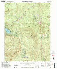
1994 Map of Green Mountain
USGS Topo · Published 2001About this map
Pike National Forest dominates this mountain landscape in Colorado, where the transition from high-altitude peaks to protected wilderness is documented in detail. The map highlights the intersection of the Colorado Trail and Stoney Pass, illustrating the network of paths used for recreation and resource management in the late 20th century. To the southwest, the Lost Creek Wilderness preserves a roadless environment centered around Buffalo Peak, while the northern portion of the quadrangle shows localized development near Wellington Lake and the Buffalo Meadows Group Campground. Evidence of small-scale infrastructure appears at Webster Park and a local Gravel Pit. The drainage patterns are well-defined by numerous waterways like Redskin Creek and Little Scraggy Creek, which carve through the granitic terrain of Redskin Mountain and Green Mountain.
Find a feature on this map
30 named features on this map. Tap any name to fly to it.
Don’t see what you’re looking for? This feature index may not catch every label — zoom into the map to look around manually.
Map Details
Editions of this 1994 Green Mountain Map
2 editions found
Other maps of this area

1893 · Platte Canyon
USGS Topo · 1:125,000

1945 · Platte Canyon
USGS Topo · 1:24,000

1945 · Pine
USGS Topo · 1:24,000

1945 · Bailey
USGS Topo · 1:24,000

1948 · Pine
USGS Topo · 1:24,000

1948 · Platte Canyon
USGS Topo · 1:24,000

1949 · Bailey
USGS Topo · 1:24,000

1953 · Denver
USGS Topo · 1:250,000

1954 · Deckers
USGS Topo · 1:24,000

1954 · Green Mountain
USGS Topo · 1:24,000