
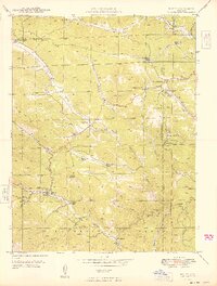
1949 Map of Bailey
USGS Topo · Published 1949About this map
Bailey sits at the heart of this post-war mountain landscape, where the North Fork South Platte River winds through the northern reaches of the Pike National Forest. The settlement pattern in 1949 reflects a transition from early pioneer ranching to more established mountain communities. Numerous named family properties such as the Isham Jones Ranch, Lydia Ranch, and Fitzsimmons Ranch are scattered along the drainages of Elk Creek and Deer Creek.
Find a feature on this map
47 named features on this map. Tap any name to fly to it.
Don’t see what you’re looking for? This feature index may not catch every label — zoom into the map to look around manually.
Map Details
Editions of this 1949 Bailey Map
2 editions found
Other maps of this area

1893 · Platte Canyon
USGS Topo · 1:125,000

1899 · West Denver
USGS Topo · 1:125,000

1903 · Georgetown
USGS Topo · 1:62,500

1905 · Georgetown
USGS Topo · 1:62,500

1945 · Pine
USGS Topo · 1:24,000

1945 · Bailey
USGS Topo · 1:24,000

1945 · Shawnee
USGS Topo · 1:24,000

1948 · Pine
USGS Topo · 1:24,000

1948 · Shawnee
USGS Topo · 1:24,000

1953 · Denver
USGS Topo · 1:250,000