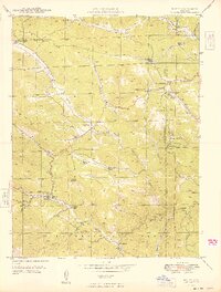
1949 Map of Bailey
USGS Topo · Published 1949About this map
Bailey sits at a critical junction along the North Fork South Platte River, serving as a hub for the scattered mountain ranches and recreational settlements in the late 1940s. The landscape is defined by its family-named ranching history, with operations like the Potter Ranch, Isham Jones Ranch, and Shaffer Ranch occupying the gulches and plateaus. Social life in this mountain community is anchored by rural landmarks such as the Pine Gulch Sch and Dry Creek Sch, alongside the Pine Gl Cem and Horn Cem. The presence of the Bailey Ranger Sta and the Bailey Camp Grounds underscores the area's role in forest management and early tourism. Following the river downstream, the settlements of Insmont and Estabrook highlight the importance of the rail corridor through the narrow canyon, providing a detailed look at the infrastructure that sustained these mountain enclaves before mid-century modernization.
Find a feature on this map
50 named features on this map. Tap any name to fly to it.
Don’t see what you’re looking for? This feature index may not catch every label — zoom into the map to look around manually.
Map Details
Editions of this 1949 Bailey Map
2 editions found
Other maps of this area

1893 · Platte Canyon
USGS Topo · 1:125,000

1899 · West Denver
USGS Topo · 1:125,000

1903 · Georgetown
USGS Topo · 1:62,500

1905 · Georgetown
USGS Topo · 1:62,500

1945 · Pine
USGS Topo · 1:24,000

1945 · Bailey
USGS Topo · 1:24,000

1945 · Shawnee
USGS Topo · 1:24,000

1948 · Pine
USGS Topo · 1:24,000

1948 · Shawnee
USGS Topo · 1:24,000

1949 · Bailey
USGS Topo · 1:24,000