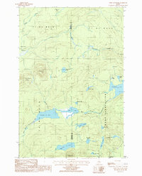
1986 Map of Green Mountain
USGS Topo · Published 1986About this map
Rockabema Lake and the surrounding wilderness of the Moro Plantation define this landscape on the Penobscot and Aroostook county line. The interior is largely dominated by extensive water systems, including Pleasant Lake and the branching West Branch Mattawamkeag River. At this time in the mid-1980s, the area remained characterized by its dense network of bogs and small ponds like Mud Lake and Tote Road Pond, with very limited human settlement aside from the small outpost at Halls Corner.
Find a feature on this map
36 named features on this map. Tap any name to fly to it.
Don’t see what you’re looking for? This feature index may not catch every label — zoom into the map to look around manually.
Map Details
Editions of this 1986 Green Mountain Map
This is the sole edition of this map. No revisions or reprints were ever made.
Other maps of this area

1940 · Island Falls
USGS Topo · 1:62,500

1940 · Oxbow
USGS Topo · 1:62,500

1942 · Island Falls
USGS Topo · 1:62,500

1942 · Oxbow
USGS Topo · 1:62,500

1954 · Shin Pond
USGS Topo · 1:62,500

1954 · Grand Lake Seboeis
USGS Topo · 1:62,500

1954 · Presque Isle
USGS Topo · 1:250,000

1958 · Presque Isle
USGS Topo · 1:250,000

1960 · Presque Isle
USGS Topo · 1:250,000
1965 · Oxbow
USGS Topo · 1:62,500