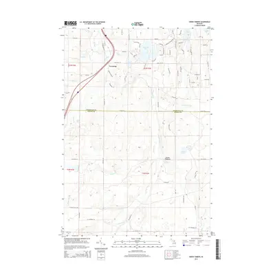
2014 Map of Green Timbers
USGS Topo · Published 2014About this map
The Sturgeon River and Pigeon River valleys dominate this 2014 survey of the northern Lower Peninsula, marking the boundary between Cheboygan and Otsego counties. The landscape is defined by its glacial hydrology, featuring numerous water bodies such as Wildwood Lake, Lance Lake, and Pickerel Lake. In the northern half of the quadrangle, residential development and recreational infrastructure cluster around the lakes, evidenced by a dense network of local roads like Golfview Dr and Avenue Du Chalet.
Find a feature on this map
79 named features on this map. Tap any name to fly to it.
Don’t see what you’re looking for? This feature index may not catch every label — zoom into the map to look around manually.
Map Details
Editions of this 2014 Green Timbers Map
This is the sole edition of this map. No revisions or reprints were ever made.
Other maps of this area

1954 · Gaylord
USGS Topo · 1:62,500

1954 · Hetherton
USGS Topo · 1:62,500

1955 · Cheboygan
USGS Topo · 1:250,000

1957 · Tower
USGS Topo · 1:62,500

1957 · Wolverine
USGS Topo · 1:62,500

1958 · Cheboygan
USGS Topo · 1:250,000
1975 · Gaylord SW
USGS Topo · 1:24,000

1982 · Petoskey
USGS Topo · 1:100,000
1986 · Saunders Creek
USGS Topo · 1:24,000
1986 · Green Timbers
USGS Topo · 1:24,000