
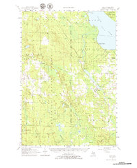
1957 Map of Tower
USGS Topo · Published 1958About this map
Black Lake State Forest dominates this mid-century landscape in Cheboygan County, where the Detroit and Mackinac railroad cuts a diagonal path toward the shorelines of Black Lake. The settlement of Tower serves as a local hub near Tower Pond, while small rural centers like Afton and Legrand dot the western edge of the forest. This survey captures a moment of transition in rural education, specifically labeling School No 1 (Abandoned) and School No 2 (Abandoned), documenting the decline of the one-room schoolhouse system in favor of larger districts.
Find a feature on this map
65 named features on this map. Tap any name to fly to it.
Don’t see what you’re looking for? This feature index may not catch every label — zoom into the map to look around manually.
Map Details
Editions of this 1957 Tower Map
3 editions found

Other maps of this area

1954 · Gaylord
USGS Topo · 1:62,500

1954 · Hetherton
USGS Topo · 1:62,500

1955 · Atlanta
USGS Topo · 1:62,500

1955 · Cheboygan
USGS Topo · 1:250,000

1957 · Wolverine
USGS Topo · 1:62,500

1957 · Cheboygan
USGS Topo · 1:62,500

1957 · Mullett Lake
USGS Topo · 1:62,500

1957 · Onaway
USGS Topo · 1:62,500

1958 · Cheboygan
USGS Topo · 1:250,000

1958 · Grace
USGS Topo · 1:62,500